We are eight middle aged guys, 57-68 years young, that share a passion for gravel bike riding. In August of 2021, we rode 375 miles self-supported, across Washington state, almost entirely on gravel bike trails and primitive roads. I will post articles about our training, planning and of course the lessons and experiences of the trip. Our wish is that you will gain something from our experiences that will help make your next big ride – epic.
Originally, we were going to loosely follow the Cross Washington route http://crosswashington.weebly.com/the-route.html to plan our gravel bike trail across Washington. Early in the summer we realized that the northern course that it followed was going to put us at a higher risk for smoke and fire in August. We then focused on building the route around the Palouse Cascades trail, https://parks.state.wa.us/521/Palouse-to-Cascades, a State park trail that runs from Cedar Falls in the Cascades to Tekoa on the Idaho boarder. Instead of riding to Tekoa, we plotted a northeasterly route on the Columbia Plateau trail to Spokane. Below I list the trails in order as we rode them. Later I will provide more detail about detours and overnights. I also want to acknowledge the Facebook community NW Gravel Riders who provided input into our planning. (20+) Northwest Gravel Riders | Groups | Facebook

This list of trails provides an almost continuous trail across Washington, from the east side of the Puget Sound to Spokane with short transitions. There are some detours along the way due to missing bridges and trail conditions.
- Snoqualmie Valley trail (SVT)
- Iron Horse trail – beginning of Palouse to Cascades
- Palouse to Cascades trail (PTC)
- Columbia Plateau trail
- Fish Lake trail
- Centennial trail to Spokane
I recommend you use Ride with GPS (RWGPS) or similar app to plot your course. I will talk a lot more about this in a future article. The route can be downloaded and used offline. The GPS will show where you are on the map and let you know when you are off course. There are several areas along the route that have no cellular signal, so you don’t want to be in a situation where you are trying to map a route to your next location in the field.
The most common question I get is how far should a person plan on riding each day? Of course, the answer is it depends. Fitness, equipment, trail conditions and weather are the main factors. Plan 45-65 miles per day when you are going self-supported, multiple days on gravel. An alternative way to think about it is to use a 70% rule. If you can ride 100 miles multiple days on the road then plan 70 miles on the trail. If you are a mere mortal and 70 miles per day on the road is your limit then 50 miles should be your limit on the trail. Of course, days will vary. For example, going down the east slope of the cascades into Ellensburg may be a longer mileage day and climbing the sandy trail across the top of the Yakima firing range may be a shorter day in miles (not necessarily time).
This route is about 375 miles and can be completed in seven days, 53.6 miles per day on average. We rode this route in the heat of August, self-supported, carrying our sleep gear and three days of food. The plan was to camp every other night and motel the other nights. In reality, due to the heat in eastern Washington we chose to motel more to cool and refresh. I encourage you to plan ahead and be creative about where you stop to eat and sleep. The following itinerary was about 80% planned and the remaining were in the moment calls based on our progress, temperatures and availability of places to sleep. Some of us stayed in motels more than the others.
| Day | Route | Comments |
| Day 1 Saturday | Everett to Ragnar on Iron Horse (54 miles) 2,516 Ft. gain | We left Everett from Shawn O’Donnell’s Irish Grill at 8am with the threat of rain. We were all riding on tubeless tires and had a combined total of three flats over the past six months. As luck would have it, 4 miles from the restaurant, still on paved roads, Shawn hit something that took a chunk out of his tire. It would not seal, so 4 miles from the start he had to install an inner tube (ok, Greg installed it) That rear tire went on to have six more flats! Every puncture that occurred in the remaining 13 tires sealed within seconds and required no repairs. My first tip, don’t even consider a multiple day trip without tubeless tires! There were plenty of meal options in North Bend. We camped in the field, on the right just past the Ragnar sign. Depending on where you start, Alice Creek further up the trail is also a good option with a couple of tent pads. We passed a father and son pair from Alaska who were waking at Alice Creek as we passed the next morning, we befriended them later in the trip. We hung our food in the trees and it turned out to be a good idea. One of the guys woke about 3am to grunting and movement next to his tent. He yelled out to the rest of us. A few guys emerged with a flash light and didn’t see anything. We gave Greg a hard time of course. In the morning, Shawn was packed first and decided to explore while he waited for the rest of us. To his surprise, he saw a bear sitting in the middle of the trail on his haunches like a dog. The bear just stared at him, as to say, what? Shawn slowly backed away and returned to camp. It had wandered away by the time others went out to look. https://www.strava.com/activities/5772477954   |
| Day 2 Sunday | Ragnar to Ellensburg (73 miles) 1,991 Ft. gain | It was a surprisingly cold and wet August day for our day-2 start. The restrooms on the Hyak side of the tunnel were a welcome site for the hand warmers! The descent from Hyak to Cle Elum was beautiful. We ate lunch at the Red Arrow in Cle Elum. We were inspired by the food runner that literally sprinted back to the restaurant after every delivery to the picnic area behind the drive-in. The food was good, but you stop for the milk shakes with the large straws. We road a tail wind into Ellensburg. Three guys broke off the trail to stay at the KOA by the Yakima river and the rest went into town and stayed at the Best Western where they were they let us bring our bikes into the rooms. There are other motel options and some riders I learned also stayed at the rodeo grounds which are right on the trail. Evidently, you can call ahead and arrange where to camp. https://www.strava.com/activities/5772484296   |
| Day 3 Monday | Ellensburg to Vantage (41 miles) 1,470 Ft. gain | Riding out of Ellensburg was a little sandier than we had been on, but it was still a great trail. The rail bed was raised in some areas spanning small valleys providing great views of farm lands and views of I-90. The refinished Renslow bridge was awesome. You will definitely want to plan for the sandy, hot climb from the south side of the bridge across the top of the Yakima firing range. It requires at least 42mm tires and some walking may still occur. A horse and rider passed us coming down the hill. We ate freeze dried food with water boiled in a JetBoil at the summit just past the tunnel detour. You can motel or camp at Vantage. There is also camping on the other side of the river before Beverly. Definitely take a dip in the Columbia! Starting in 2022 you will be able to cross the Columbia over to Beverly and not have to ride down the highway to Vantage unless you want to stay in Vantage and then ride back to the Beverly bridge and still avoid the Vantage bridge. We chatted with one of the only two groups of riders that we saw on the trip past Hyak. They had rode in from Cody, WY. They were an impressive group of nomads headed to Forks. We didn’t want to tell them about the headwinds into Ellensburg and the pass. https://www.strava.com/activities/5772489116   Be sure to jump into the Columbia! Be sure to jump into the Columbia! |
| Day 4 Tuesday | Vantage to Othello (51 miles) 1,739 Ft. gain | We were shuttled across I-90 bridge by Devon Knudsen 509-396-4263. Eat a good breakfast before heading out or stop at the gas station near Beverly for a breakfast burrito. There are no other options until Othello. In Othello there are motels, grocery stores, several Mexican restaurants and a Walmart. Coincidently, the father and son pair that we saw at Alice Creek were also staying at the same motel. Al, the father introduced himself and his son Simon. They were from Alaska and doing their own across Washington ride. They literally put their bikes back together in the airport terminal, dipped their tires in the Sound and headed east. We crossed paths a couple more times at motels and the finish at Shawn’s. Tip: On the way there is a stretch of goat head thorns that is worth avoiding. We overlooked the warning to get off the trail and spent at least 15 minutes pulling thorns out of our tires and watching the sealer do its thing. The only tire in the group with a tube went flat, then three more times as broken thorns worked their way through the tire and into the newly installed tubes. Avoid by staying on the road by Smyrna. https://www.strava.com/activities/5772493831  Image from the Palouse to Cascades site. see detour Image from the Palouse to Cascades site. see detour |
| Day 5 Wednesday | Othello to Ritzville (66 miles) 1,906 Ft. gain | It is worth stopping in Lind to experience an eastern Washington old town. Lind has a grocery/deli. The café (opens at 4pm) and Slim’s Tavern, operated by an eye patch wearing 86yr old named Skip, seemed to be open all day. If the grey Mustang is out front then they are open. Lind had a fire scare this summer. You will see the scorched ground ends at the edge of town. We chose to ride north from the trail to motel in Ritzville. There are plenty of motels, grocery, fast food and restaurants in Ritzville. Cow Creek had a great selection of pizza, calzone, sandwiches, and ice cream. Instead of riding into Ritzville, you can camp on a tent pad just south of Ralston. I have read that water is also available there. It was 102 degrees the day we rode, so a Ritzville motel was an unanimous choice. https://www.strava.com/activities/5788023072  Cold beer anytime, no food until dinner time. Cold beer anytime, no food until dinner time. |
| Day 6 Thursday | Ritzville to Downs Lake (44 miles) 1,522 Ft gain | The first 20 miles of the Columbia Plateau trail (CPT) is 2″-5″ railroad rock. There was some interesting topography, but I still recommend riding around it. We jumped off at the first opportunity, 11 miles in and 3 hours of riding. The side roads, some are primitive are a great option. At one point we road 5-6 miles on a country road and saw no cars either direction. A motivated group could ride straight into Spokane, especially if they rode around the first section of the CPT. We stayed the night at Downs Lake Resort. It is not exactly a resort, but it was a great place to camp and hangout the last night. We played horse shoes and relaxed in the shade. Ride with GPS https://ridewithgps.com/routes/37424017 (detour of Columbia Plateau rail rock – meandering country roads 50% gravel, big climb to finish) https://www.strava.com/activities/5788026721 If you follow this route, do not get off the trail until it intersects with Lamont rd.   |
| Day 7 Friday | Downs Lake to Spokane (36 miles) 846 Ft. gain | It is an easy ride from Downs Lake to Spokane. The gravel was good and turns to pavement after Turnbull Wildlife Refuge. There is a detour from one part of the Fish Lake trail to the next. If you find yourself riding through what looks like a rock quarry then you are on the route! You will get spoiled by a mostly down hill paved path to Spokane and finish with a small windy climb out of the river valley into Spokane on the Centennial trail. Yes, it was smoky the last day, but overall, we hit a good window of clear days in eastern Washington. I encourage you to finish your ride with a meal at Shawn O’Donnell’s Irish and American Grill on Monroe. They will allow you to bring your bikes inside. Have them take a picture of your group and I will get it added to the hall of fame (or at least this site). Ride with GPS https://ridewithgps.com/routes/37047822 https://www.strava.com/activities/5788029086   |

One of 6 tire repairs for Shawn 
Red Arrow in Cle Elum 
Trail by Lake Keechelus 
Slim’s in Lind 
Skip, Slim’s owner 
Camping in Ragnar 
The mighty Columbia 
Who would of know? 
Cruising into Spokane on Fish Lake trail 
A welcomed sight east of Ellensburg 
Riding into the mist at the pass 
Cle Elum rail station 


A smoky sunrise east of Ritzville 
Enjoying the tailwind into Ellensburg 
Putting on the lights and clothes for the Snoqualmie tunnel 
A curious visitor 
A primitive road in eastern Washington 

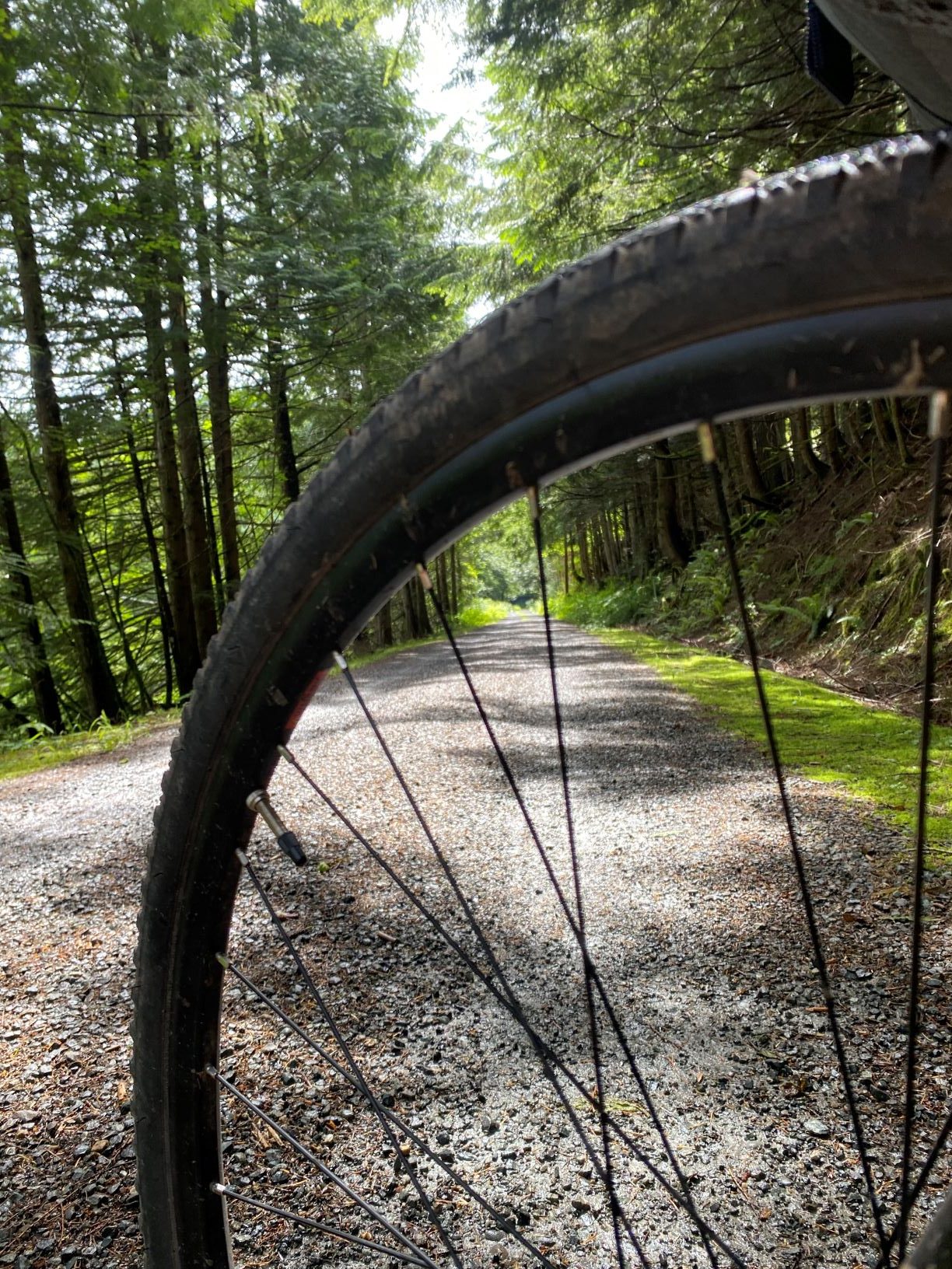
On the Iron Horse 
A little delirious on day 6 


Karl, Rolf, Mark L., Shawn, Greg, Jim and Mark F.
Come back to learn more about equipment, planning and some of the lessons we learned along the way. I enjoy the comments and questions, so tap away.


Nice job Mark
Great job Mark
The 11 miles in 3 hours was maybe more walking than riding.
The 11 miles in 3 hours was maybe more walking than riding.
Love the recap
Great trip information
Awesome work Mark. It was an adventure in every way.
very awesome, I been trying to win a gravel bike, I have a road bike and a hybrid for a ride like this a gravel bike would be great. However, I have done a century on my hybrid so it would work just fine. I would love to do this someday. or something like it.